


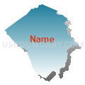
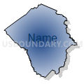
Pitt County--Greenville City PUMA, North Carolina
About
Outline

Summary
| Unique Area Identifier | 193665 |
| Name | Pitt County--Greenville City PUMA |
| State | North Carolina |
| Area (square miles) | 654.82 |
| Land Area (square miles) | 651.97 |
| Water Area (square miles) | 2.85 |
| % of Land Area | 99.56 |
| % of Water Area | 0.44 |
| Latitude of the Internal Point | 35.59106520 |
| Longtitude of the Internal Point | -77.37240380 |
Maps


Graphs
Select a template below for downloading or customizing gragh for Pitt County--Greenville City PUMA, North Carolina


Neighbors
Neighoring Public Use Microdata Area (by Name) Neighboring Public Use Microdata Area on the Map
- Carteret, Beaufort & Pamlico Counties PUMA, NC
- Craven County PUMA, NC
- Lenoir, Onslow (North) & Jones Counties PUMA, NC
- Nash & Edgecombe Counties--Rocky Mount City PUMA, NC
- South & West Albemarle Sound & Northern Outer Banks Regions PUMA, NC
- Wilson & Greene Counties--Wilson City PUMA, NC
Top 10 Neighboring County (by Population) Neighboring County on the Map
- Pitt County, NC (168,148)
- Craven County, NC (103,505)
- Wilson County, NC (81,234)
- Lenoir County, NC (59,495)
- Edgecombe County, NC (56,552)
- Beaufort County, NC (47,759)
- Martin County, NC (24,505)
- Greene County, NC (21,362)
Top 10 Neighboring County Subdivision (by Population) Neighboring County Subdivision on the Map
- Greenville township, Pitt County, NC (49,564)
- Winterville township, Pitt County, NC (46,280)
- Washington township, Beaufort County, NC (14,838)
- Grimesland township, Pitt County, NC (11,746)
- Belvoir township, Pitt County, NC (9,334)
- Chocowinity township, Beaufort County, NC (9,290)
- Township 1, Craven County, NC (8,656)
- Pactolus township, Pitt County, NC (8,154)
- Ayden township, Pitt County, NC (7,525)
- Farmville township, Pitt County, NC (6,703)
Top 10 Neighboring Place (by Population) Neighboring Place on the Map
- Greenville city, NC (84,554)
- Winterville town, NC (9,269)
- Ayden town, NC (4,932)
- Farmville town, NC (4,654)
- Grifton town, NC (2,617)
- Bethel town, NC (1,577)
- Bell Arthur CDP, NC (466)
- Grimesland town, NC (441)
- Fountain town, NC (427)
- Simpson village, NC (416)
Top 10 Neighboring Unified School District (by Population) Neighboring Unified School District on the Map
- Pitt County Schools, NC (168,148)
- Craven County Schools, NC (103,505)
- Wilson County Schools, NC (81,234)
- Lenoir County Schools, NC (59,495)
- Beaufort County Schools, NC (47,759)
- Edgecombe County Schools, NC (45,606)
- Martin County Schools, NC (24,505)
- Greene County Schools, NC (21,362)
Top 10 Neighboring State Legislative District Lower Chamber (by Population) Neighboring State Legislative District Lower Chamber on the Map
- State House District 9, NC (88,399)
- State House District 6, NC (82,016)
- State House District 10, NC (77,125)
- State House District 23, NC (75,657)
- State House District 3, NC (73,905)
- State House District 8, NC (69,997)
Top 10 Neighboring State Legislative District Upper Chamber (by Population) Neighboring State Legislative District Upper Chamber on the Map
- State Senate District 5, NC (183,899)
- State Senate District 2, NC (183,118)
- State Senate District 10, NC (181,431)
- State Senate District 1, NC (179,312)
- State Senate District 11, NC (177,074)
- State Senate District 3, NC (167,669)
Top 10 Neighboring 111th Congressional District (by Population) Neighboring 111th Congressional District on the Map
Top 10 Neighboring Census Tract (by Population) Neighboring Census Tract on the Map
- Census Tract 6.03, Pitt County, NC (9,570)
- Census Tract 3.02, Pitt County, NC (8,858)
- Census Tract 9602, Craven County, NC (8,637)
- Census Tract 9, Pitt County, NC (8,052)
- Census Tract 16, Pitt County, NC (7,843)
- Census Tract 13.03, Pitt County, NC (7,689)
- Census Tract 9603, Craven County, NC (6,858)
- Census Tract 5.02, Pitt County, NC (6,706)
- Census Tract 6.01, Pitt County, NC (6,686)
- Census Tract 4, Pitt County, NC (6,567)
Top 10 Neighboring 5-Digit ZIP Code Tabulation Area (by Population) Neighboring 5-Digit ZIP Code Tabulation Area on the Map
- 27858, NC (55,781)
- 27834, NC (52,914)
- 27889, NC (27,468)
- 28590, NC (23,407)
- 27886, NC (21,591)
- 28513, NC (10,346)
- 27828, NC (9,071)
- 28586, NC (8,218)
- 27817, NC (7,358)
- 28530, NC (7,332)